What Is Real-Time People Tracking? A Practical Guide for Enterprise Operations
Real-time people tracking explained for enterprise teams: how RTLS works indoors, where it pays back, and what consent and compliance actually require.
Ask ten operations managers what “people tracking” means and you will get ten different answers. One is thinking about a fire drill that took forty minutes to confirm everyone was out. Another is thinking about a contractor who signed in at the gate and was never seen again until the shift ended. A third is thinking, quietly, about whether any of this is legal.
All three are asking the same underlying question. Where are my people right now, and what happens if I do not know?
Real-time people tracking, defined
Real-time people tracking is the continuous, consented location of personnel inside a defined site, accurate enough to act on and fast enough to matter. Three parts of that sentence carry the weight.
Consented means the people being located know they are being located, know why, and know what happens to the data. Systems that skip this step do not survive contact with a works council, a union, or a regulator.
Inside a defined site is the technical crux. GPS is a satellite system. It needs line of sight to the sky and it degrades badly the moment a roof intervenes. Inside a warehouse, a hospital wing, a refinery or a basement car park, GPS is somewhere between unreliable and useless. Everything interesting in this category happens indoors, which is why it needs a different class of technology entirely.
Accurate enough to act on is a deliberately loose standard, because the right accuracy depends entirely on the decision you are making. Confirming a muster at an assembly point needs zone-level accuracy: is this person in the safe area or not? Finding a specific infusion pump on a hospital floor needs room-level accuracy. Preventing a forklift from entering a pedestrian corridor needs sub-metre accuracy and sub-second latency. Buying UWB precision to answer a zone-level question is an expensive way to be right.
How it works, without the marketing
Four components appear in almost every deployment.
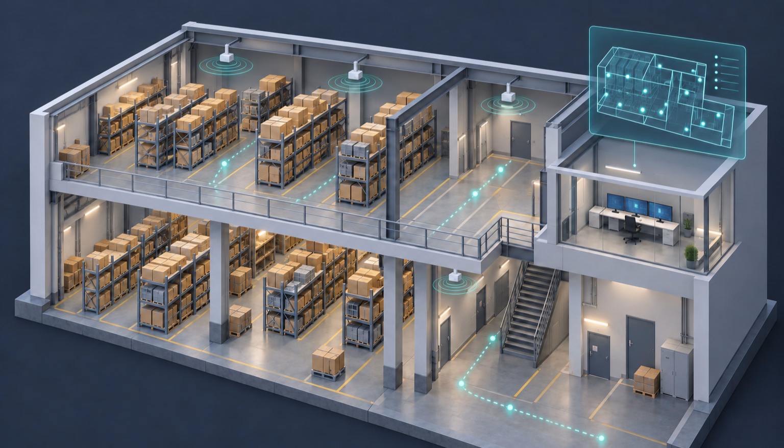
Tags are what the person carries. In practice this is a badge holder, a lanyard tag, a hard-hat clip or a wearable. Battery life ranges from a few months on an aggressive beacon interval to several years on a conservative one.
Anchors are fixed reference points mounted through the site, usually on ceilings or walls. They receive the tag’s signal and time or measure it. Anchor density drives both accuracy and cost, and it is the number most vendors are vague about in early conversations.
The location engine turns raw signal into coordinates. This is where trilateration, angle-of-arrival calculation, filtering and sensor fusion happen. It is also where two platforms using identical hardware diverge sharply in real-world accuracy.
The application layer is what anyone actually sees: live floor plans, zone rules, alerts, muster boards, dwell-time analytics, integrations into your existing systems.
The signal technology underneath varies. BLE with angle-of-arrival typically lands around a metre. Ultra-wideband reaches ten to thirty centimetres but needs denser infrastructure. Wi-Fi round-trip time reuses access points you may already own, at one to two metres. Passive RFID gives you read-point events rather than continuous position, which is enough when you only care about gates and thresholds. Most mature deployments end up mixing two of these rather than committing to one.
Where it actually pays back
The business cases that survive procurement fall into a short list.
Emergency mustering. A site that takes thirty minutes to account for four hundred people after an alarm can usually get to under three. On a site with regulated evacuation drills, this alone often carries the project.
Lone worker safety. A technician in a plant room who stops moving for ninety seconds triggers an alert with a location attached, rather than being found at the end of the shift.
Contractor and visitor accountability. Knowing who is on site, in which zone, for how long, and being able to produce that record for an auditor.
Restricted-zone enforcement. Alerting when someone without the right certification enters an area that requires it, before anything happens rather than after.
Flow and bottleneck analysis. Aggregated, anonymised movement data showing where time is lost. This is usually the one that funds phase two.
The part most guides skip
People tracking is not asset tracking with different tags. The technology overlaps almost completely. The governance does not.
An asset has no rights. A person does. That means purpose limitation written down before deployment, data minimisation in the retention policy, transparency to the workforce, and a genuine answer to “what happens to this data outside working hours”. In the UAE, Saudi Arabia and India, all three of which now have operative data protection regimes, these are not optional courtesies.
The organisations that deploy this successfully tend to do one thing consistently. They bring the workforce in before the hardware goes up, they publish what is collected and what is not, and they resist every request to use safety data for performance management. The ones that fail usually failed at that meeting, not at the installation.
Where to start
Pick one zone and one question. Not the whole site, and not five use cases. A single building, a single measurable outcome, ninety days. You will learn more about your own anchor placement, tag ergonomics and integration debt in that one pilot than in six months of vendor demonstrations